Subject: ANN0000orq
Comments
-
 by
hyderAli
by
hyderAli
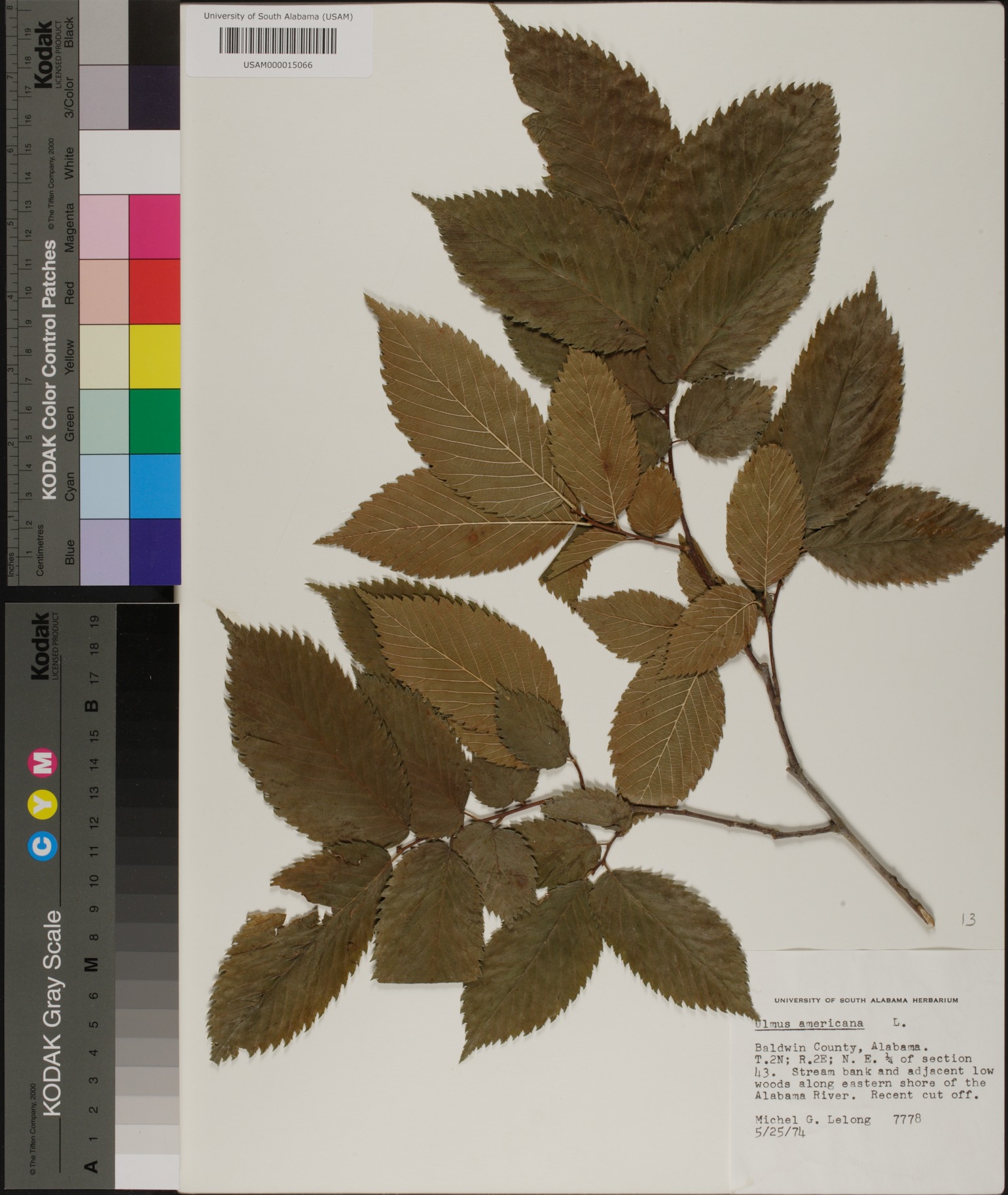
Coordinates (T.2N; R.2E; N.E.) should be included on location, correct?
Posted
-
 by
SandersClan
by
SandersClan
That's where I put them. ")
Posted
-
by
nosenabook
Me, too. Do collectors use special maps when collecting, or is this the usual designation in some places?
Posted
-
This notation is often used in states that fall under the Public Land Survey System (township & range).
Posted
-
Colored states in this map: http://en.wikipedia.org/wiki/File:Meridians-baselines.png
Posted
-
by
nosenabook
Thanks. The map explains why it seems so common and yet I'd never heard of it. I've lived in VA, KY, NC, and one miserable year in Ohio.
Posted
-
Yeah, I've always lived in NC, which uses metes & bounds rather than township & range.
Posted
-
Learned about PLSS while doing field work in Idaho. http://prezi.com/agggqcsfh8ac/township-range-and-metes-and-bounds/
Posted
-
by
ecovrar
before (hand held) GPS that was the accessible coordinate system. It meant going out into the field with a topo map - or better yet - cont
Posted
-
by
ecovrar
- a Soil Cons Serve (now NRCS) county soil survey map. it was the best source of aerial photos prior to Google/ Keyhole
Posted